At a Glance
Distance: 8.5 miles
Elevation Gain: 3,100 feet
Trailhead: Summit Trailhead – Great Basin National Park
Route Type: Out and Back
Best Time: Mid-June to Late-September
Red Tape: None
Difficulty
Grade: 14%
Exposure: Low
Class: Class 1
Overall Difficulty: Moderate
Description
Wheeler Peak is located in Great Basin National Park in Nevada. The mountain is often confused with the tallest peak in New Mexico, also called Wheeler Peak. Wheeler Peak is the second tallest peak in Nevada, with a height of 13,064 feet.
Boundary Peak is the tallest peak in Nevada, right along the California border. It is located in the White Mountains, a range in the Great Basin Desert. It is a joke, as the state’s tallest mountain. If one were to descend to the saddle and hike up neighboring Montgomery Peak less than 0.75 miles away at 13,411 feet, you’d be looking down on Boundary Peak (13,140 ft).
While technically not the highest mountain, Wheeler Peak feels like the state high point. You would have to travel over 230 miles by carrier pigeon to find a taller mountain when standing on the summit of Wheeler Peak.
It is also the 12th most prominent peak in the lower 48. With a prominence of 7,563 feet, Wheeler Peak easily classifies itself as an Ultra Prominent Peak.
Great Basin National Park
Great Basin National Park is one of the least visited National Parks in the country, and it is also one of the most underrated. The park is known for its diverse landscapes, high-elevation forests, and a collection of bristlecone pines over 6,000 years old.
Located in eastern Nevada near the border with Utah, Great Basin National Park and Wheeler Peak are exceptionally remote. The nearby town of Baker has limited services with fuel and a taco truck. Lodging and a sitdown meal will require a visit to Ely, Nevada, or Delta, Utah. Otherwise, plan on packing in a few days worth of food and trying to secure a spot at the Wheeler Peak Campground, Upper Lehman Creek Campground, or the Lower Lehman Creek Campground.
One secret about Great Basin National Park is its proximity to Salt Lake City. Most locals believe that Arches National Park is the closest National Park to Salt Lake City. It might be if you were a crow, but in drive time on Google Maps, Great Basin National Park, even though it’s in a different state, is a closer drive than any other of the five National Parks in Utah.
The drive into the National Park is beautiful in its own right. US-50, the highway that Life Magazine dubbed America’s Loneliest Highway is the primary gateway to the park.
Alternatively, Wheeler Peak can be reached in a 4.5 hour drive from Las Vegas via US-93. There isn’t much in eastern Nevada, so
When you first enter Great Basin National Park, there is an early junction. Continuing straight will take you to the Lehman Caves Visitor Center, while bearing right will take you up the Wheeler Peak Scenic Drive.
Wheeler Peak Scenic Drive
The Wheeler Peak Scenic Drive involves a climb of over 3,600 vertical feet. The scenic drive offers incredible views of the surrounding landscape, including the Great Basin Desert, Wheeler Peak, and the Snake Range Mountains.
Be sure to stop at Mather Overlook and snap a few pictures. Great Basin National Park is also excellent for stargazing and stellar Milky Way galaxy photos. The Mather Overlook is a great place to set up shop with a tripod at night.
The Start of Your Hike: Trailhead to Stella Lake
To get to the Wheeler Peak Summit Trailhead, sometimes abbreviated to the Wheeler Peak Trailhead, follow the signs up the Wheeler Peak Scenic Drive after entering Great Basin National Park.
The Wheeler Peak Summit Trailhead is roughly 11 miles from the start of the scenic road and is marked. The parking area is small and the 19 spaces fill up on weekends in the summer.
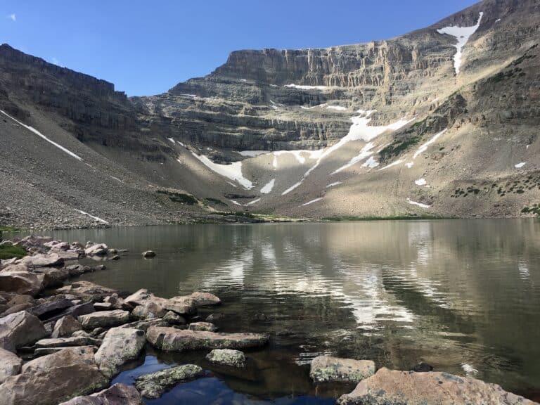
The Wheeler Peak Trail begins modestly as it wanders through the forest with a limited incline. About 1.1 miles into the hike, you’ll reach a junction for Stella Lake. Stella Lake is beautiful and worthy of a visit. On both of my summit hikes, I stopped at Stella Lake for a snack on the way back and enjoyed the sunshine and views.

Side Trip from Stella Lake: The Alpine Lakes Loop
For those looking for a more adventurous hike, consider adding miles along the Alpine Lakes Loop or turning it into a day hike.

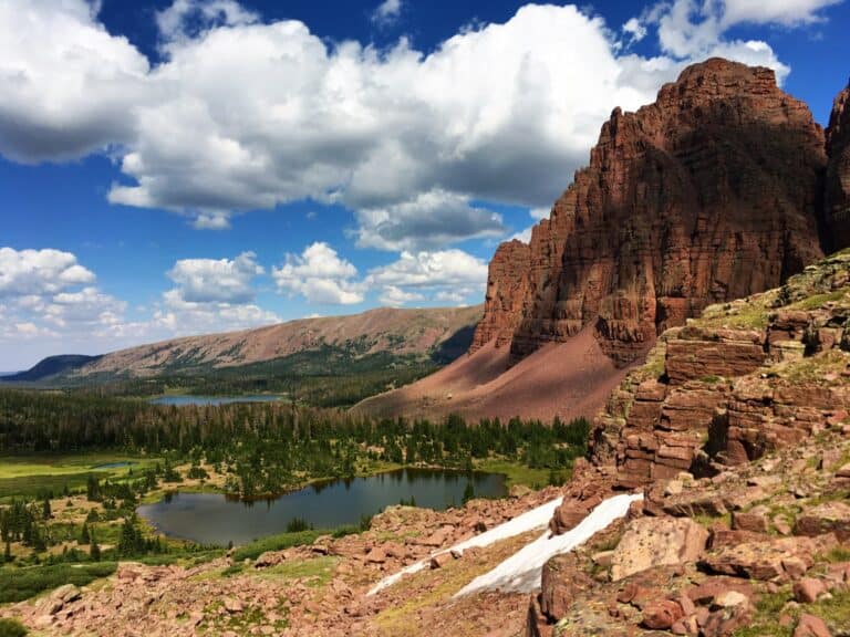
The Alpine Lakes Loop takes you past several beautiful alpine lakes, including Stella Lake, Leahy Lake, and Baker Lake. The loop also offers stunning views of the Great Basin’s mountainous landscape, including Wheeler Peak, the second highest peak in Nevada.
The Alpine Lakes loop is also home to some unique vegetation. The trail passes through alpine meadows and the Bristlecone pines. There’s also the opportunity to see some wildlife, including mule deer, mountain lions (supposedly), and several species of birds.
Stella Lake to the Wheeler Peak Summit

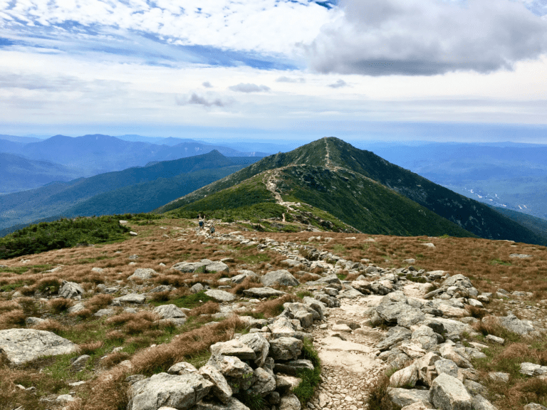
After the trail junction, your next objective is the saddle at roughly 10,850 feet. The quartz-covered ridgeline and peak are clearly in view. From here, you depart the protection of the forest as the rest of the hike is above the tree line.
Now you leave behind the easy hiking, and the real climbing begins. The Wheeler Peak Trail continues to steepen all the way to the summit. The last half mile of hiking has an elevation gain of over 900 feet.

If you begin your day at lower elevations, the air feels thin at 12,000 and 13,000 feet. On one of my trips, I found a campsite at the Wheeler Peak Campground. The Campground is on a first-come, first-served basis and was packed the second time I summited Wheeler.
The views from the summit are otherworldly. Panoramic and hundreds of miles in every direction. Some might call the desert boring, but I find it stunning. This is a great hike.
From the Wheeler Peak summit looking east, you can follow the ridge of the Snake Range to Jeff Davis Peak. A few brave souls have tackled this peak across an exposed ridge filled with loose rock.
Right below you in the Wheeler Peak Glacier. The Alpine Lakes Loop will take up to the glacier’s base if you follow past the Bristlecone pines.
Looking north, you can see the saddle that you just ascended. The ridge leads up an open hike to Bald Mountain.
To your south is Baker Peak, and past that, Mount Washington. A rough Jeep road will take you into the southern end of Great Basin National Park to Mount Wheeler mine. A handful of people will use that road to start a bushwack hike to Mount Washington.

Weather can move in quickly. With the elevation of the desert over 8,000 below the top of Wheeler Peak, the summit is no place to be during a storm. Luckily the hike back down from the summit isn’t too long. Trekking poles are helpful when descending Wheeler Peak, especially the first mile from the summit. Reaching the safety of the tree line is pretty close by for a 13,000-foot peak.
Lehman Caves
If you have time, consider a tour of Lehman Caves. You need to book it in advance at Recreation.gov. It’s worth checking the Lehman Caves Visitor Center for walk-up availability.
The cave is known for its display of stalagmites, stalactites, flowstone, helictites, and shield formations. The limestone caves offer visitors a glimpse into the underground world of the park.
How long does it take to hike Wheeler Peak?
It takes the average hiker 4-6 hours to hike to the summit and return to the Wheeler Peak Summit Trailhead. In the summer, a snowless Wheeler Peak Trail isn’t a very challenging route for such a tall mountain. The last mile is steep and will test you when coming from sea level. If you’re in relatively good shape, hiking the Wheeler Peak Trail is easy.
Best of Instagram
Trail Map
Alternate Routes
Off-trail routes for Wheeler Peak are possible but not well documented. The most obvious route to the summit is the south ridge.
